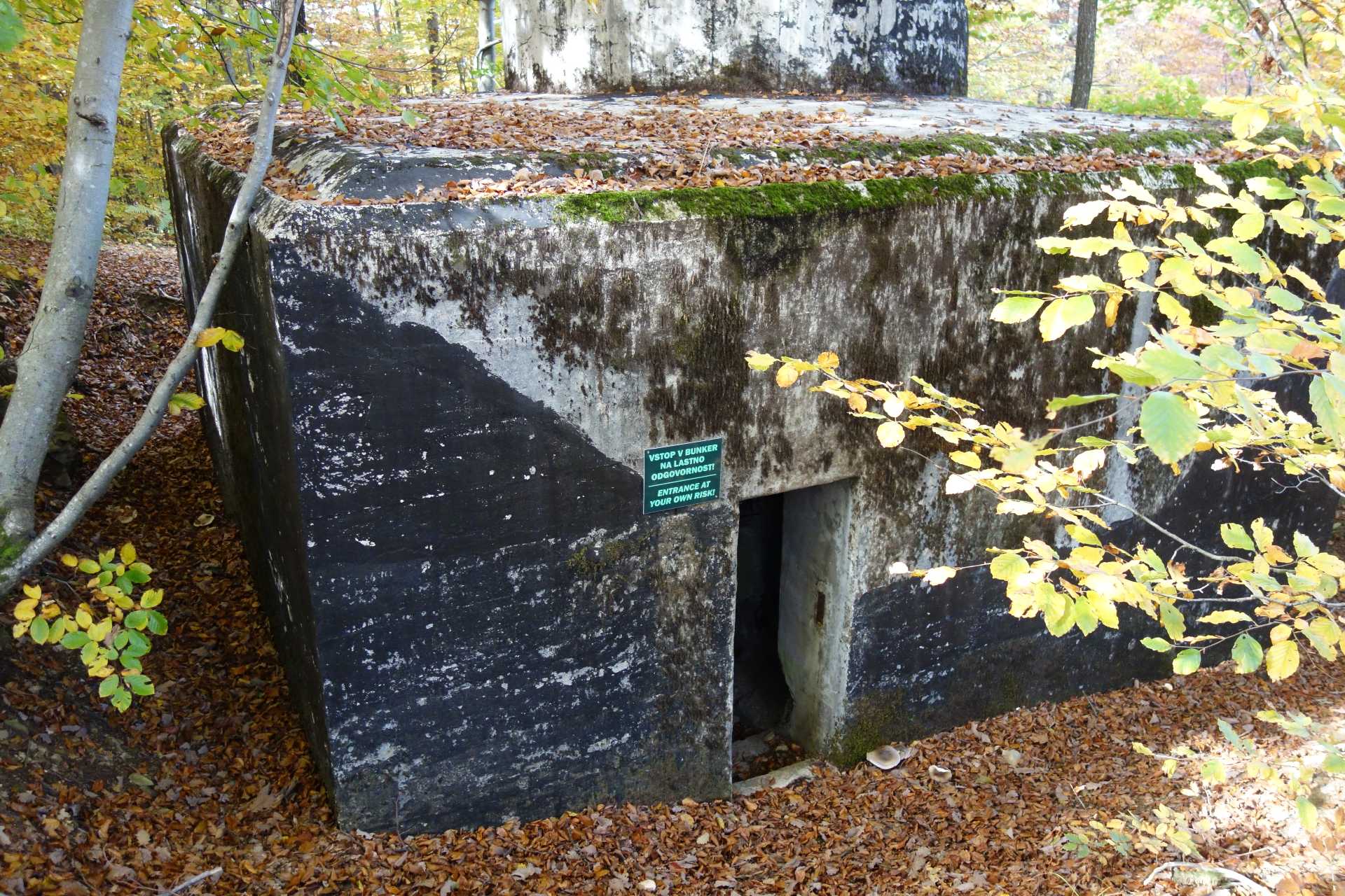
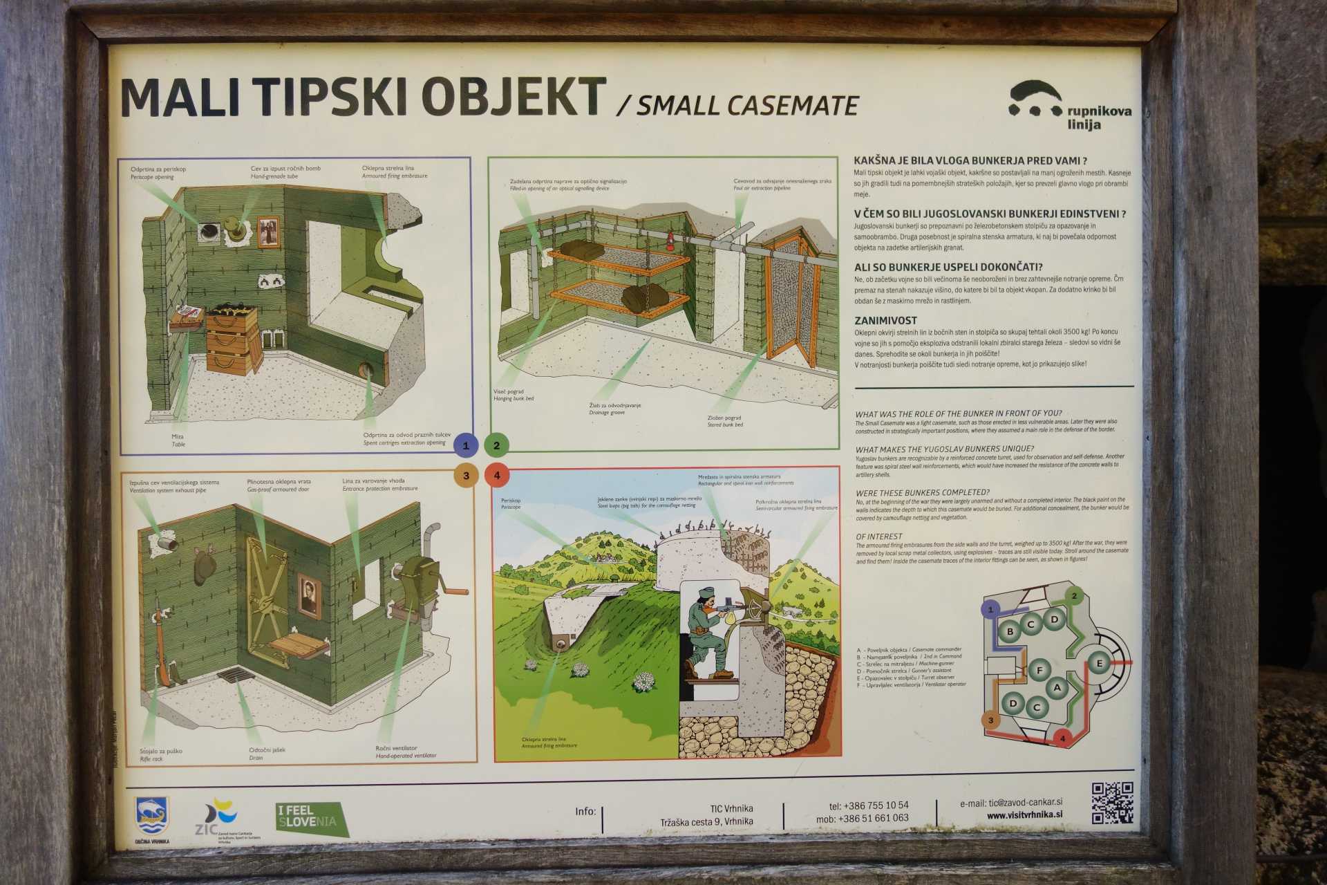
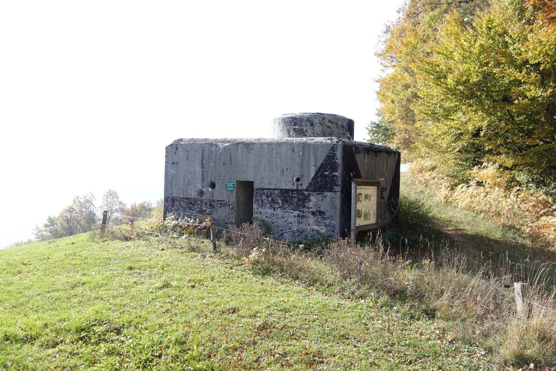
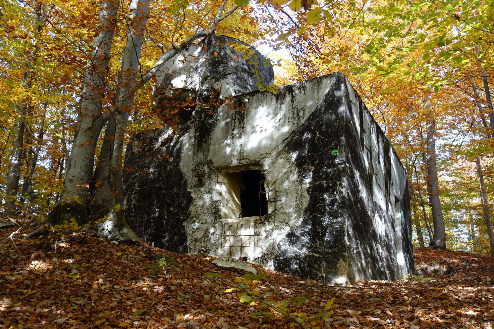
One of the interesting and pleasant excursions around Sweet Stay Forest House is a circular path past several fortifications from the mid-20th century, along the Rupnik line. The trip is unpretentious and also suitable for families with young children. The path is marked and leads us past many learning tables, bunkers – which can also be viewed inside. Energy points are also found along the way, which have a beneficial effect on many internal organs (heart, lungs, thyroid, uterus, ovaries, intestines, bile and others). The high difference on the way is 138 m. The round trip is 3 km long and the trip will take from 1h 20 min to 2 h (depending on how detailed you read the boards). The visit is suitable in all seasons.
History
The Western line of defence, called the Rupnik line, was built by the Kingdom of Yugoslavia in 1937 in response to the Alpine Wall, which the Kingdom of Italy built right along the Rapal border, obtained by the 1920 peace agreement. The line of defence was named after Leon Rupnik, the general who led the construction work. The work took place between 1937 and 1941, with 60,000 soldiers and civilians working on it at its peak. The entire line ran from Jalovec over Blegoš, Žirovski Vrh, Logatec and onwards to Rijeka, and more than 100 bunkers were built.
This area had great military significance also during the Roman era, as the path leads us past the remains of the Roman Defence Wall, Claustre Alpium Iuliarum. The time of its creation dates back to the second half of the 3rd century.
Despite the roughly 1,500-year time difference, the two lines of defence are strikingly similar after an unimaginably large amount of time, resources and effort by people to build them. Interestingly, the Roman Wall is supposed to defend the “Italians” from the “eastern people”, while the Rupnik line is supposed to defend the “eastern people” from the Italians. Both defensive lines also had a similar ending. Although the Romans managed to build the barrier, it never served its purpose, and the construction of the Rupnik line was interrupted by World War II.
Napoleon’s Fountain
At the end of the road, we also pass Napoleon’s Fountain. According to the local people, it was built for the needs of French soldiers, who later occupy Ljubljana. Until the construction of the water supply, it was the only source of drinking water in the area, as it never drys.
Route
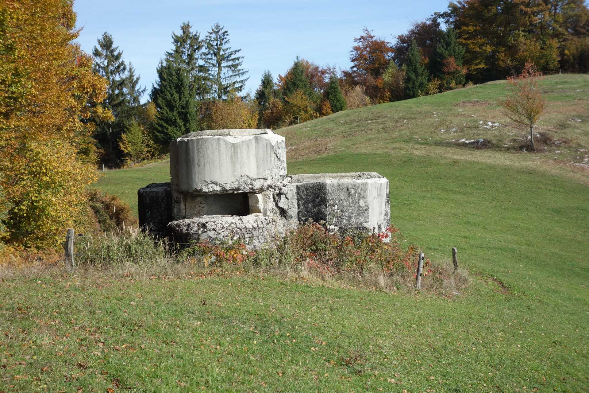
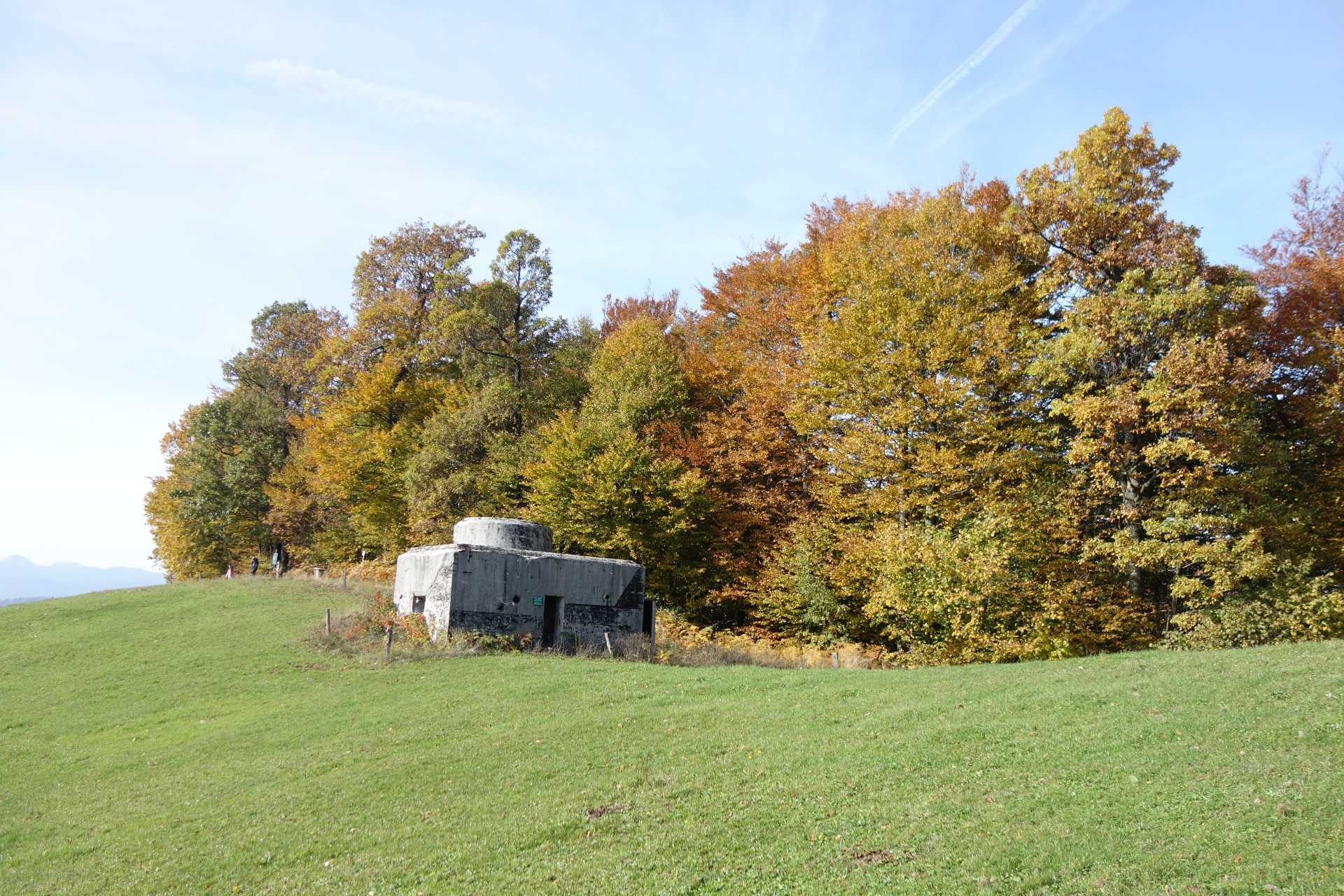
The starting point of the route is at the restaurant Mesec, Jerinov hill 44, Vrhnika. We should go across the parking lot of the Restaurant Mesec and climb the short stairs behind the decorative fountain onto the road. Here we go left. The roads are held up for a few tens of metres when we notice the green signpost for the Rupnik line, which leads us left to the footpath. We walk along the right edge of the meadow, where we can see the remains of the Roman Defence Wall. The path leads us to a large learning board, the bench and the first healing energy point. This is where the path turns left and leads us into the forest. Hereafter the path is completely laid down and leads us to the next learning board next to the remains of the bunker, which was demolished by the Italian army at the beginning of the occupation. After a short ridge part, we descend down to the right onto the gravel road, or so-called “military route”. We stick to it all the way, and it brings us to the pasture with the view, where the next bunker is located at the edge of the forest. Nearby are benches, a viewing pad and three healing energy points. This is where the view of Javornik, Snežnik, Slivnica, Ljubljanski vrh and other peaks opens. At the edge of the forest we descend to the pasture, where we continue straight into the forest. Here we come across the next learning board, the two well-preserved bunkers and an energy point. The path leads us past the left bunker downwards. After a short descent, the signpost directs us to the right, to the next learning board and a bunker. From here we continue to the right through the forest. The path descends and quickly leads us to the crossroads, where the markation shows right, while our path leads to the left and downwards. In a few minutes we descend to the paved road, from which we return to the starting point.